This is a PRIVATE website owned by John Skakel. Contact us HERE
Cemeteries Office Staff have asked that users NOT contact them with questions directly.
The Hubbell - Minshall Cemetery
 The Hubbell - Minshell Cemetery
With Special Thanks to Bruce Grainger
And Alphonse Vanhooste
GPS location.
Back middle. 42.53682 ...... 82.00089
Front middle. 42.53674 ...... 82.00071
Nearest buildings location 911 number - 12713 River Line.
In early summer of 2012 we were told by Bruce Grainger of a cemetery on the edge of the river almost at his former farm home. The little we know of this cemetery at the moment is the following...
- About 55 to 60 years ago there was an old hand pump at the cemetery location. Was this installed for the cemetery use? We do not know and of course now we probably never will.
- In that same time period depressions in the ground could be seen where some of the burials probably were located.
- Some time before that time there was apparently a flood that caused rather severe damage to the river bank. At that point there were some graves lost and there are rumours of some burials being exposed.
- Former research indicated that some of the burials there MIGHT be of members of the Hubbell Family and the Minshall Family. They were related through marriage. We do not know even the last names of any others who lie there.
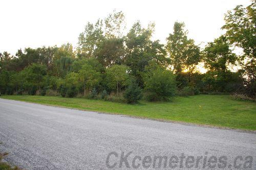
In the early fall of 2012 we did some dowsing of the area, and found the old cemetery. Although Bruce Grainger knew where it was located, it was lost totally for almost everyone else. It measures approximately 24 meters by 24 meters. There are indications of at least two rows of burials in a "Potter's Field" formation at the back along the river, and this is separated from the rest of the cemetery by a very narrow walkway. There is at least one small area of babies in the back just North East of center point. Dowsing indicated quite a large number of burials within the area. We have not taken the time to count them at this time. We have been told that the river used to be a short walk back of the cemetery. Now it is known that some graves lie wholly or in part in the area that has been taken over by the river. i.e. those graves or part of them have been destroyed.
As with all other cemeteries, if you know further history of this one please let us know. We would love to find out the names of some folks who lie there. The time it was first used and the time of the last burial. All of these bits of information are so very important now to find and save before they are lost forever.
If you have further information for us please email - pmn39@gmail.com
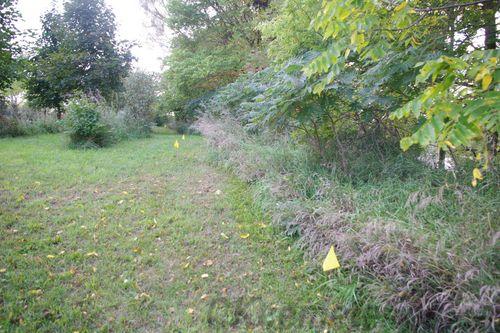
The back of the cemetery. Note the River middle right.
The two flags in the middle indicate a probable "Baby's Field" area.