This is a PRIVATE website owned by John Skakel. Contact us HERE
Cemeteries Office Staff have asked that users NOT contact them with questions directly.
God's Acre
The Old Fairfield Hutberg Cemetery
With Special Thanks To Darryl Stonefish and the Delaware Nation of Moraviantown
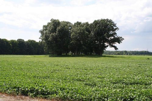
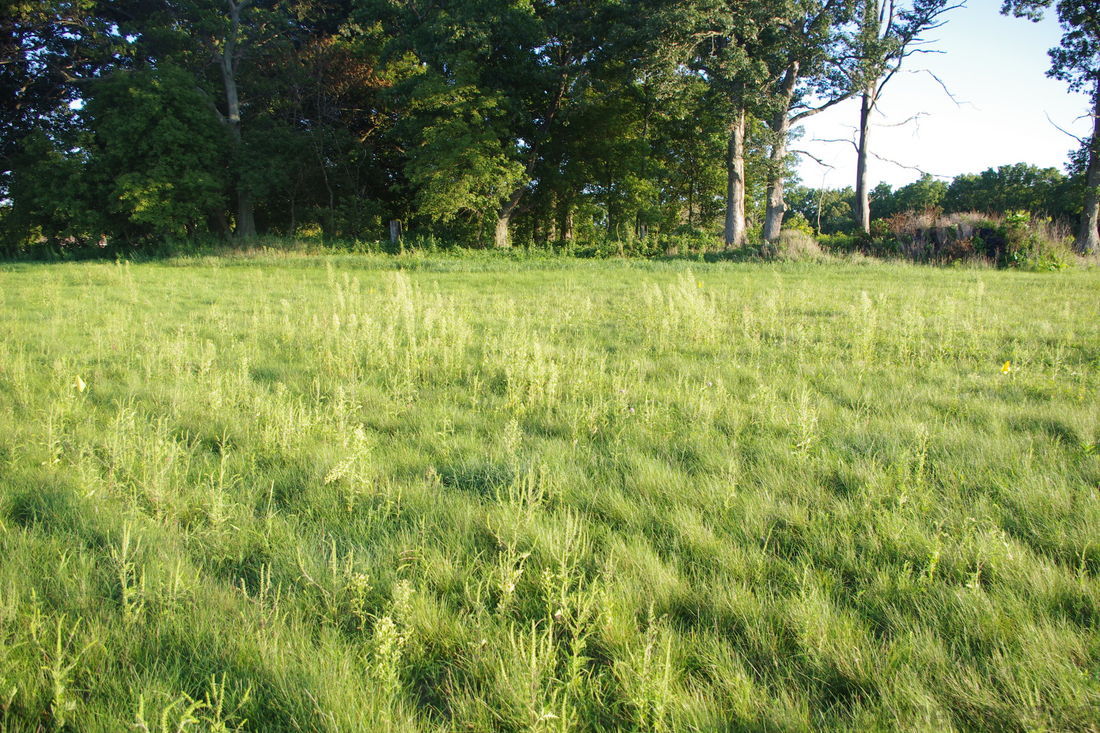
Hutberg Cemetery as we see it today.
Please note that Shoenfeld is a direct translation of Fairfield.
Geographic Locations.
probable farm buildings middle 42.58712� 81.90529�
probable church building middle 42.58700� 81.90559�
potter's field middle 42.58696� 81.90591� NE to SW 30' NW to SE 70'
W corner 42.59681� 81.90518�
back of Hutberg 42.58683� 81.90577�
babies area # 1 inside of Hutberg Cemetery 42.58664� 81.90551�
base of stone visible inside Hutberg. Likely base for Haman Monument. 42.58672� 81.90537�
baby area # 2 inside of Hutberg Cemetery 42.58654� 81.90540�
S corner 42.58632� 81.90533�
E corner 42.58673� 81.90486�
To better understand this historical site, please see also the history of the NEW Fairfield Cemetery Here
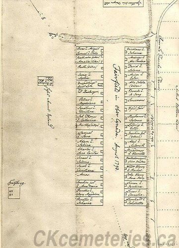
Diagram showing Old Hutberg in relation to Fairfield
The other square similar to the cemetery
was a large turnip garden.
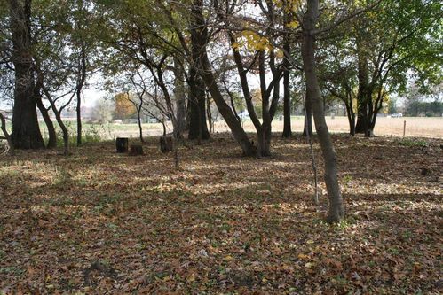
Part of God's Acre as we see it today
To understand Hutberg Cemetery, you need to understand a bit of history of Fairfield. Please Click
See more photos of the Cemetery and the stones that used to be located there that are now in Bothwell cemeterey
The Old Hutberg Cemetery is located just North West of the Fairfield Museum on the former hwy 2 now Longwood's Road. There are a lot of misunderstood facts about it,
Hutberg was not a cemetery of war. It was indeed a cemetery of peace. The Moravians along with many Deleware Natives came to Fairfield to find peace after a terrible massacre in their former home lands. They thought that they were so far away from everything that no one would bother them. but instead they built almost on top of what was to become a battle in the War of 1812. This was not a huge battle. In fact it was relatively small. BUT it was a very important one in our history. Those soldiers and native warriors under Chief Tecumseh who died on the field of battle were not interred here though. They rest elsewhere.
To see the photos more clearly please expand your screen. With most browsers use Control and +. Then use Control and 0 to return to normal.
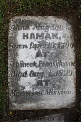
Haman Anna Magdalene's stone now
in Bothwell was originally in Hutberg.
The Probable base of her monument
still resting in Old Hutberg Cemetery
One of the oldest monuments in Chatham-Kent.
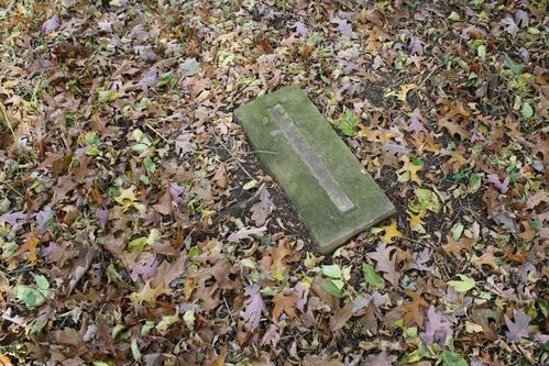
Likely the base of Haman Anna Magdalene's monument
There are really two cemeteries in the Hutberg grounds. One is about 75 feet in front of the other. The front of the cemetery is not now correctly marked. It actually extends slightly into the farmer's field on the Southern point. However, it is said that it you take a line from that corner to the Eastern corner, that the line between is parallel to the road as it existed in those times. i.e. the road that you can see today in the small "Village area" beside the Fairfield museum across the present road. The front South East border of the cemetery is not at all accurate as we see it today. It actually extends a few feet into the farmer's field on the Southern side as mentioned. Also, the South Western side is not accurate either. At the front of the cemetery it extends a fair number of feet into the farmer's field. At the back, there is one tree for instance that is not even in the cemetery. The other two sides of the cemetery are roughly accurate the way that they can be seen today.
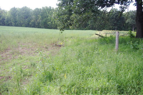
The front of Hutberg Cemetery.
Note the location of the flags in the farmer's field.
To see flags expand using Control + or appropriate browser controls
And return to normal use Control 0
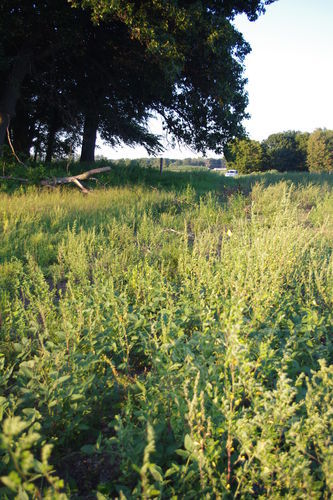
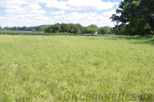
The front of the Cemetery
When photo taken camera was at
location of it's Southern corner
The Christian Natives in good standing were interred in the front cemetery. The non Christian folks were interred in the Potter's Field in back. (Please see photo of Potter's Field and Diagram below.) That area is at the moment not marked permanently. It is not centred, but is really more on the Westerly side in the back area. It has been lost for decades, and I fear that it will very soon be lost again.
It has been documented apparently that many times in Moravian Cemeteries that men were interred together. Married women together. Babies together. Young girls together. etc. We do not have any documentation on this being done at Hutberg, but sensing indicates that the cemetery seems to be "Full". i.e. there are few blank spots. IF they were buried in families, with their own plots there would likely be blanks spots in there. Thus it now seems very possible that burials in Hutberg were done in groups with men together etc as mentioned above.
The first burial in the Hutberg Cemetery must have been Thomas, Grandson of the Delaware Chief Netawatwes. He did on May 8 of 1792. The Moravians came to Fairfield at slightly different times over a few days, but this was only 3 days after the Sensemanns and Brother Edward first came to the site.
See a list of the names of the deaths in OLD Fairfield as listed in their Diary.
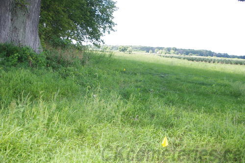
North East side. Note Flags showing location of last burials.
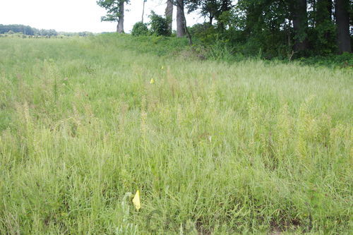
South West side.
Note flags showing location of last
burials. There are burials right up to those flags.
There are two babies areas that we have so far found. One is very near to the Southern Corner, and it can easily be found on the South West side. One is further down that side about half way to the back. These sites of course are filled with shafts that would contain babies. Remember that in those times many babies and children died. (Note the list of "Those buried in God's Acre [Hutberg]" on this web site linked from this page.)
There is one base for a stone that can be seen on the site. The stones from Hutberg were moved by the Moravian Missionaries to Bothwell Cemetery when they moved out of Moraviantown leaving the mission work there to others. Those stones can now be seen in Bothwell Cemetery in the very back Eastern Corner. It is very likely that the stone base still to be seen in Hutberg is for Anna Magdalene Haman. The stone sizes match exactly, so unless there was two stones of that exact size in Hutberg (unlikely), that is the burial that the stone indicates.
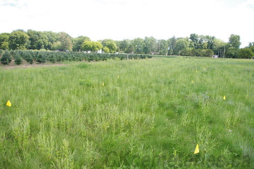
Four flags just beyond show location of what
we think may well be the Methodist turned Anglican Church there.
To see flags more clearly expand using Control + or appropriate browser controls
And return to normal use Control 0
Three small buildings on NE side of the lot may indicate
the location of the farm owned by Chief Phillip Jacobs
We do know that the Moravians moved the monuments to Bothwell when they withdrew from Moraviantown. However, we do not know in most cases if any remains were moved. There does seem to be one shaft in existence under a monument in Bothwell. Other remains would have been probably skeletal by then, so could have been placed in small holes if they were moved, thus making detection difficult. Please realize here that sensing these things can be difficult. Finding a whole cemetery is probably pretty hard to go wrong. But working with one shaft is a totally different story.
Among the last burials in Hutberg were Chief Phillip Jacobs, Jorger Isaac Torgersten, and Mary Ann Vogler. There are remains of three small buildings in the area. It is known that Chief Phillip Jacobs lived near here and these could be all or part of his farm. Again, please realize that we are pretty certain these buildings existed, but we can only guess that they might be his farm buildings.
There was a church located on the site near the cemetery for over 20 years. There is evidence of a relatively large building located just behind the main Cemetery, and more or less in front of and to the North East of Potter's Field. The size of this indicates that this building just MIGHT be the former church, but there is little way now to prove that for certain. Around 1843 the Methodist Church Circuit Riders began to visit the Moravian Mission, and in 1850 a church was built. It is said to have cost $300 gold, 1/3 of which was paid for by the Methodist Society. However, this they thought gave them license to "Run" the church, and soon they found the doors locked on them. The Church of England was invited in and they took over until some time after the funeral of Chief Phillip Jacobs in 1870. Darryl Stonefish has mentioned that this transfer to a less strict church had a bit to do with the Moravians finally leaving the mission in 1903. This last fact gives it a much more prominent place in history than we might ordinarily give it.
Note. On April 7 1794, in the Fairfield Diary it mentions... "The brothers cleaned up the cemetery and built a fence around it."
We must stress that there are rumours that the remains were moved from both this cemetery and New Fairfield site and reinterred in the new cemetery. However, Darryl Stonefish mentions that at one point it was realized that the old river was encroaching on some graves in NEW Fairfield cemetery, and thus some burials from the very back of it were moved to the new cemetery rather than being buried again in New Fairfield. However, this only involved a FEW graves in the back of NEW Fairfield and did not involve OLD Fairfield's God's Acre. The only ones that may have been moved from there that we know of are the missionaries in Bothwell.
SPECIAL NOTE: When the Archaeological and Reconstruction work on the site was being considered in the late '40's and early '50's, the land for the project was purchased from Wm R Leverton.
It is extremely important that if you visit this or other native cemeteries that you treat them with a great deal of respect. Native culture includes the belief that the spirit of the deceased person lives on through these remains. Places like this are VERY sacred to them.
Flags mark edges of Potter's Field in this case really a separate cemetery said to be about 25 meters (75 feet)
behind the main cemetery. Only Christian Natives would be buried in the main cemetery along with the missionaries.
See more photos of the Cemetery and the stones that used to be located there that are now in Bothwell cemetery
With special thanks to Darryl Stonefish and the Delaware Nation.
With references from Wilderness Christians by Elma E Gray
And a history of the Delaware Nation of Moraviantown by Darryl K Stonefish.
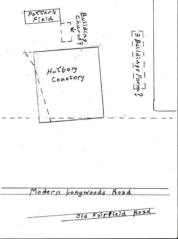
Note that dash lines are what the cemetery boundries LOOK like today. Solid lines are the actual burial boundries.
Note that distances are not correct, and distance of cemetery from road is shown compressed to allow
viewing of the whole image on one diagram without making image load slowly.