This is a PRIVATE website owned by John Skakel. Contact us HERE
Cemeteries Office Staff have asked that users NOT contact them with questions directly.
The Old Salem Cemetery and Church
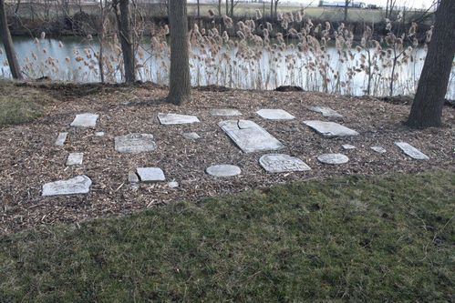
The few remains of the Old Salem Cemetery.
With a Special Thank You to Cleo and Donna Perry
The Old Salem Church was a small frame building located on the farm of the late Samuel Shaw about 1/4 mile from Lindsays Tile Yard on the north shore of the east branch of the Sydenham River. The cemetery, which was a part of the village of Keith, a thriving village boasting of a Post Office,store and blacksmith shop. It was located where the 90 degree turn in the road is now. There was a cable ferry at the end of 25(Brigden Sideroad) The Dusten Family ran the Post Office there for many years, and the Lindsay family owned much of the land in the area.
Salem was simply an old church name which was really just a shortened version of the word "Jerusalem". The Salem Church was a Methodist Church. The church had a Centennial in 1979 so it was likely built in 1879. It was abandoned in 1905 so it was only used for about 26 years. We do know that the end came when it was just too structurally unsound to be further repaired. Sensing suggests that there was one large room in the front of the church, and a smaller one at the back. The large granite stone monument on the site today sits in the middle of the large front room of the church. In the '60's, Garnet Fauser collected money for the stone memorial to the little church and cemetery.
Salem had it's own burial area as part of the Church. Was it simply for Church members? We do not know at this point. But we do know it's likely location and that it was likely last used around 1905 when the Church was sold. The stones were still standing in the cemetery around 60 years ago. They had been removed by the township Council and were thrown down on the river bank in a pile some 40 years ago (from this year of 2012).
To see more photographs of Old Salem Cemetery Click Here.
The following diagram shows the approximate location of Old Salem Church and the old Cemetery in relation to the road, the new memorial stone to Pioneers, and the River. Please note that this is a sketch only! This is not a map to scale!
We wish to thank Cleo Perry for pulling the stones from the river and saving them. This shows that he is a VERY caring person!
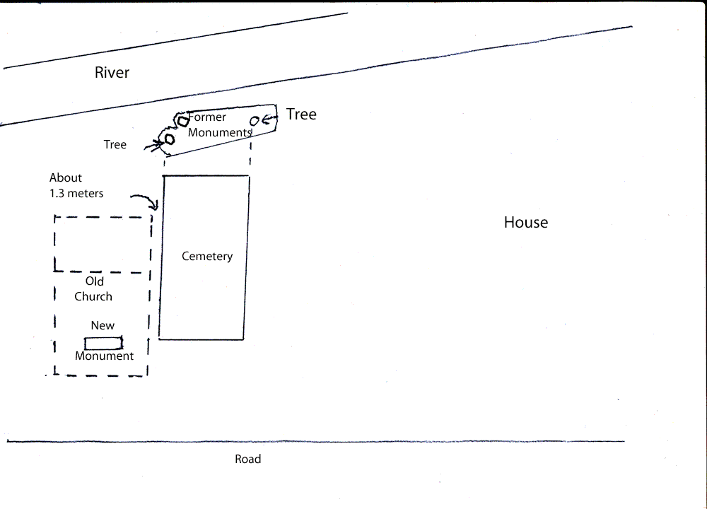
Diagram of Old Salem showing approximate location of Church and Cemetery
Note that at this time the sides of the cemetery line up approximately with two trees
at each end of the location where the old stones have been placed.